
IMPORTANT NOTICE!
Activities and vehicle modifications appearing, described, recommended, or linked to on this web site may be potentially dangerous.
We do not endorse any such activity for others or recommend it to any particular person.
These are simply the experiences and opinions of the writers.
If you choose to engage in these activities it is by your own free will and at your own risk.
Any and all modifications will likely cause a vehicle to behave differently than stock - some modifications may significantly increase your risk for an accident
or equipment failure when driving the vehicle or be dangerous in some driving situations.
Use common sense when engaging in any activity or making any modifications.
Do not take unwise risks, consult a certified professional if you are not sure of something, if you are uncomfortable with your mechanical ability, if you don't
have the experience to do a project, if you have not received proper training and education for the job you are thinking about doing, or if you do not have the proper tools, equipment or safety devices to do the job you are considering.
The owners, operators, members (or any associated parties) of the JEEPEXPEDITIONS.ORG web site and the writers / authors of the content contained within this web
site are not liable or financially responsible for any damages including -- but not limited to -- emotional, physical, or financial damages incurred during or after
the use of this web site or any content contain within.
|

Equipment Reviews: NATIONAL GEOGRAPHIC TOPO STATE SERIES
This is what THEY say about it:
TOPO! State Series Software for PC & MAC
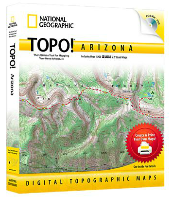
National Geographic's best selling, top-of-the-line, digital map software is the easiest way to create and print detailed maps. Each
program includes thousands of the highest quality USGS topographic maps, optimized for printing and ease of use.
TOPO! gives you five levels of map detail, from two National Geographic Atlas maps to a USGS 1:24,000 scale (7.5) seamless topographic
mapthe most detailed outdoor recreation maps available. Maps include:
With TOPO!s dynamic search features, you can quickly find your area of interest. Or simply browse the map to locate your desired destination.
TOPO! maps are full color, high resolution scans of authentic USGS topographic maps, providing the best image quality available. All maps are
seamless, and easily printed from your home printer. Paired with National Geographic AdventurePaper, our waterproof, tear-resistant material,
your maps become trail-tough.
TOPO! is the easiest way to tell your GPS where to go. Simply trace your route and upload to your receiver. Use in reverse to create detailed
trail maps from your adventures
- National Geographic Atlas Maps
- USGS 500,000 Scale Maps Highlights public lands
- USGS 100,000 Scale Topographic Maps Mid-Scale topos perfect for long trips
- USGS 24,000 Scale Topographic Maps The most detailed terrain maps available
Here Is What WE Say About It
There is lots of software out there for Laptops, NetBooks, Tablets and GPS Units themselves. The big three are Garmin, Delorme and National Geographic.
Actually there are the big two now as it pains me to say that National Geographic has gotten out of the digital map arena. But read on because if you
really want some great software, you can still find it online at places like Ebay and Magellen's new Triton series comes standard with Nat Geo Topo! (Did
they buy the rights? I've asked Magellen for some info but they never got back to me).
While all software is similar they are not all created equal. Lets's face it, all of the companies that produce topo software gets their information from
USGS Topo Quads. It is the resolution they offer that sets them apart. One thing to be sure, is that the USGS does not update their maps on a regular basis
so the maps you might be seeing could be 10 or 20 years old. For government work it's no big deal as topographic details rarely change with the exception of
a natural disaster like Mt Saint Helens. I hear people saying all the time that "this software stinks, it's missing half the trails".
Well this could be true but software that isn't 1:24,000 or 24K isn't going to show you every trail or even complete trails that the originl maps might have
shown. Newer trails won't show up on any of them (are there any "legal" new trails on public lands?). Trails on National Geo TOPO! are not routeable, a
shortcoming it shares with both Delorme & Garmin 100K topo which in many cases give you a route that is a straight line that goes from point to point, not a line that
follows the trail. Garmin 24K Topo will do automatically route trails between way points. 24K sells for about the same as the Nat Geo (around $100
for each state). Pricy but if you demand the best and won't settle for adequate, then you should spend the money.
The Windows interface takes a bit to get used to as there are no navigational scroll bars on the side of the bottom of your screen to move to different areas of
the map. You need to move the curser to the edge of the map and then click on the arrow until you get to area you are looking for. It might take some getting
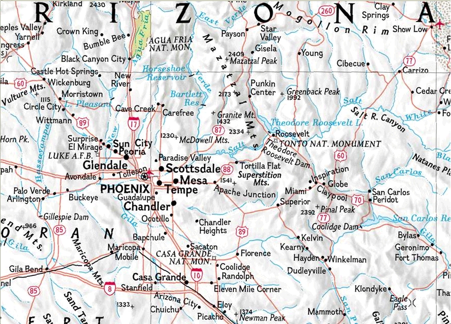
used to but other popular programs are similar not just Nat Geo. One thing I do like is the 5 layers of resolution. The first layer shows a wide area but
less detail. As you "zoom" to the next layer, detail become better and more trails show up. At the top level you are at the 24,000 scale and there is lots
more to see, more trails, better detail, more POIs but in a much smaller area. For those with computers that use Windows 8 you are out of luck. This program
does not work with Windows 8. No big deal to me, my "GPS" laptop is a Panasonic Toughbook CF29n. It don't work well with Windows 8 either so I restored it
to Windows XP. I take it EVERYWHERE in my Jeeps as it is indestructable.
The big advantage to me using this or any other software on my computer is that I can pre-plan an off-road adventure adding stops and way points, save it as a GPX
file and tranfer it to my Garmin, Delorme or any other GPS unit for use on the road and trail. Computer Topo software maps are raster-scanned directly from USGS
7.5' topos. The software in your GPS Unit are vector-graphic maps that are specific to your manufacturers GPS (meaning you can't use someone elses software in
your GPS. Vector graphic images are much less detailed than raster scanned maps so the little GPS in your vehicle or hand cannot give you the detail found on
software like National Geo's.
Other features that you'll like are the 3D views and fly-throughs, elevation profiling that allows you to draw a route then calculate elevation gain or loss,
the ability to add your own pictures and notes, plus the option to choose from either lat/long or UTM grids. You can also save your vehicle or hand held GPS
tracks and waypoints to a GPX file (most new car GPS units do NOT have this feature unfortunately and you'll have to go to an older Garmin Street Pilot or early
Nuvi for that function) and import that file to your Nat Geo software to tweak the route and save it for the future.
There isn't much not to like about this software but there are a few things that annoy me. The biggest is the color contrasts between map features and trails.
Trails can be gray or a reddish color and can get a bit lost in the browns of the elevation markings (Garmins is white which is a bit easier
and Delorme is a gray but it gets lost too in the elevation markings. I am not sure how I would change it other than possibly make trails a neon green.
Getting it to recoginze a GPS unit/antenna for its GPS signal when using with a laptop off road is a bit tricky as the options are for older units and generic
options but once you get it figured out it saves those setting for the future.
Now that I have said my piece, I can tell you that this is the program I use on my laptop in my Jeeps to track and record my progress. Once I turn the GPS on and
tell it to record my tracks, it will put down track markers are intervals you set (distance or time)and will continue to track you for your entire trip. You can
save these tracks to keep a record of your trip for future trips or share them with friends. These tracks can be uploaded to your most hand held GPS units for
future navigation. Unless you have an older Garmin unit or even a newer but discontinued Chartplotter like the GPSMAP478, you are kind of out of luck as I don't
know of any vehicle unit that you can upload saved tracks to for navigation. I find that National Geo maps do a much better job on my laptop recording my
adventures than Delorme (for some reason not as reliable) and Garmin whose discontunued the nRoute software and it won't work with their newer products. Garmin
nRoute given me reliability issues too on a laptop in the vehicle. Garmin BaseCamp as I look at it won't intereface with a GPS antenna to give your real time
data and tracking (which would for some make it unnecessary to have an actual GPS unit in the vehicle).
My recommendation, use this for real time tracking in your vehicle and save the routes for later use. This is a very good program and the fact that even though
it is discontinued is still selling at or near the original retail price in some cases shows that. I bought all the southwest states when they were available
along with a few others and am glad I
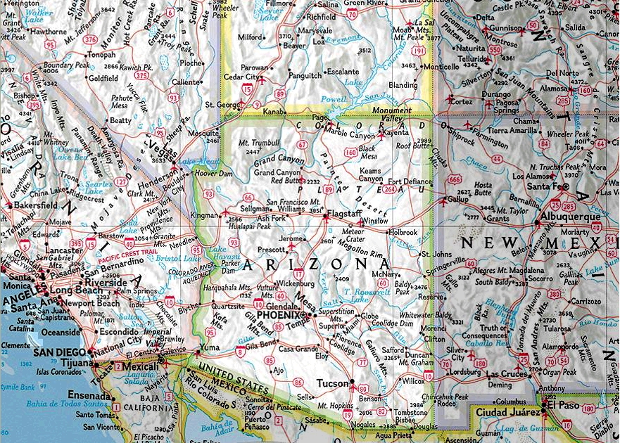
did. The Arizona map set includes nearly 2000 separate USGS maps! You just can't carry that many with you in your Jeep. The Alaska version has nearly 3200
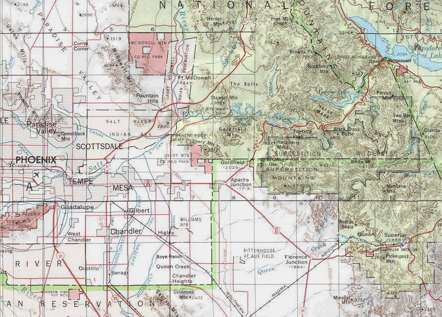
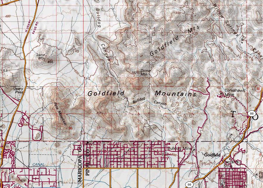
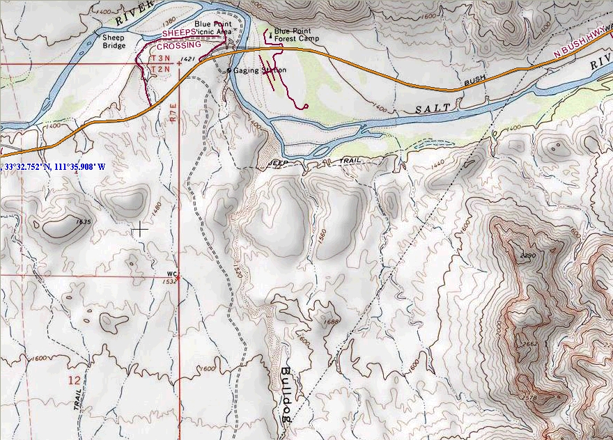
maps. This one is a buy if you want a detailed software for use in your Jeep with a Net Book or Laptop. You'll find some screen shots below of the main screen
when you boot up then levels 1 thru 5 of scale.
|
 |
Want to have YOUR Product Reviewed Here?
If you have a quality product that can be used by the off-road pubic we would be glad to test it, do a fair write up about it
and make an honest recommendation about it.
Products that we feel are useful to off-road travel whether it be Jeep related or camping related will not only be posted on our website but we will submit them
to one of several magazines for more possible exposure.
Email info@jeepexpeditions.org with detailed information about your product and your interest in working with
our organization.
------------------------------------------------------------------------------------------------------------------------------------------------------
*The opinions expressed in this product review are the opinions of the writer and are based on the writers tastes and preferences. The writer
may have and in most cases invited other people to participate in this review. Despite the review (favorable/unfavorable)
you are encouraged to try out any product that you might be interested in.
**Copyrighted images & trademarks for products/items appearing on this website and/or portrayed and reviewed here
are the property of their respective owners
and are used within for informative and identification purposes only.
|
|
Jeep Expeditions is the PREMIERE Jeep Exclusive Expedition/Overland Adventure CLUB Anywhere!
Jeep Expeditions is a non-profit corporation registered in the State of Arizona.
The state recognizes us as a fraternal
organization, we prefer to say we are a club. Our members and volunteers are dedicated to the exploration of
this great land for the educational value, historical value, scenic beauty, the geology, paleontology, the camaraderie of people
who share the same interests and to escape the confines of civilization if only for a few days. Our organization and members adhere to the
standards of "Tread Lightly" and "Leave No Trace".
Jeep Expedition Members enjoy adventures that vary in length from one day, a weekend, long weekend, week long, two weeks and like our Arctic
Expedition in 2011, a full month. Don't worry, most of our trips are one day and two day trips. We are Family Friendly and we have
a number of members who bring their friendly "Jeep Dogs".
Copyright © 2006 - 2023 Jeep Expeditions, Inc. All Rights Reserved.
Jeep Expeditions Group, Jeep Expeditions, Inc., Jeep Expeditions, JeepExpeditions USA, JeepExpeditions.org. JeepExpeditions.club,
JeepExpeditions.com and other names we use along with domain names owned by Jeep Expeditions, Inc are all Copyrights & Trademarks held by
Jeep Expeditions, Inc. d/b/a "Jeep Expeditions" We also own Copyrights and Trademarks to our logo, Trip Decals and other variations of such as shown
on this website, our Facebook Page, Twitter and Instagram accounts.
Jeep Wrangler, Jeep Wrangler Unlimited, Jeep Wagoneer, Jeep Commander, Jeep Grand Cherokee, Jeep Liberty, Jeep Cherokee, Jeep Gladiator,
Jeep Scrambler, Jeep CJ, Rubicon, Renegade, Laredo, Overland, SRT-8, HEMI, Rock-Trac, Command-Trac, Selec-Trac, Quadra-Trac, Quadra-Trac II,
Quadra-Drive, Quadra-Drive II, SmartBeam, Jeep, the Jeep logo, and the Jeep grille are registered trademarks of FCA US LLC. Throughout this
web site all the preceding marks & logos are used for identification purposes only. JEEPEXPEDITIONS.ORG is an independent web site and is not
affiliated with FCA US LLC. Other trademarks and images used throughout this web site are the property of their respective owners, have no affiliation with
Jeep Expeditions and are used for informational and identification purposes only.
Terms Of Use: You may not hold the owners, operators, members (or any associated parties) of the
JEEPEXPEDITIONS.ORG or any other Jeep Expeditions, Inc /Jeep Expeditions Group web sites liable or financially responsible for any damages
including -- but not limited to -- emotional, physical, or financial damages incurred during or after the use of this web site. Use of this
web site constitutes an agreement to these Terms Of Use.
|
| |