Here Is What THEY Say About It
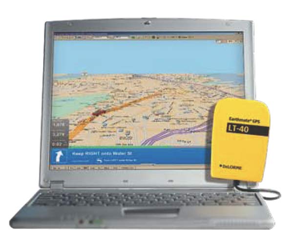
Earthmate GPS LT-40
One of the smallest on the market, measuring just 1 7/8 w x 2 5/8 h x 9/16 thick.
Comes with an attached 5 cable with a suction cup on the cable designed to hold the GPS against the windshield or on the dash for optimum performance. Just plug the other end of the cable into the USB port of your laptop PC or UMPC.
The Ultimate Off-Road & On-Road Bundle
Topo USA 7.0 is the Most Up-to-Date Topographic Mapping Software Available
As the innovation trendsetter in topographic mapping and GPS technologies, DeLorme Topo USA 7.0 continues to lead the way with advanced capabilities that provide a more meaningful outdoor experience. In addition to the highly-detailed Topo USA and DeLorme Street Network maps, you can access a wide variety of indispensable map, chart, and imagery choices from USGS, NOAA, and other sources.
Street Atlas USA is Much More Powerful than Online Mapping
Comprehensive tools for detailed desktop planning of your vacation or sales trip BEFORE you go, AND for on-the-go traveling using the latest electronic gear. Most other vehicle GPS systems are NOT planning tools and only track as you go. Support for Windows Vista, Pocket PCs, Windows Mobile 5.0 and later, UMPCs, and Palm OS included.
Everything You Need for City and Rural Travel
Automatic street routing in the U.S. and Canada, automatic trail routing in the U.S., four million places of interest and much more.
Amazing 3-D Flyovers
Newly designed 3-D mapping engine produces lifelike views of your favorite terrain. Explore the terrain before you head out and select only the roads you want for GPS usage.
The Most Complete Selection of Data and Imagery Options
In addition to the highly-detailed Topo USA and DeLorme Street Network maps, you can access a wide variety of indispensable map, chart, and imagery choices from USGS, NOAA, and other sources.
Unrivaled GPS Capabilities
Topo USA 7.0 delivers high-end GPS data creation and exchange capabilities and lets you do more with data you collect in the field.
NEW! Now Over 4 Million Places of Interest from Trusted DeLorme Products
Now ALL your trip planning information is at hand, from travel to a trailhead, to campgrounds, fishing spots, and provisioning on your way, including:
* From Street Atlas USA®
attractions, lodgings, restaurants, stores, post offices, much more.
* From the Atlas & Gazetteer series
boat ramps, campgrounds, fishing and hunting spots, unique natural features.
GPS to Natural Landmarks & Four Million Places of Interest
Visit national parks, forests, trails, public lands, mountains, lakes, rivers, and other included outdoors locations.
Here Is What WE Say About It
So what exactly does LT-40 stand for? L=Lap / T=Top? If not it should! What a GREAT device and a GREAT price!
Personally, I have been using laptops with mapping software and dash mounted/hand held GPS units since the mid 90s. My 1st use of mapping software using GPS was on a Dell laptop using DeLorme software and a DeLorme serial GPS receiver in the mid 90s. That was long before GPS became a household word. I grew to like Delormes software, its ease of use, accuracy and the fact that every year they updated it with new roads and POIs.
After a while of using both a small GPS unit on the dash for general driving and moving up to Panasonic Toughbook Laptops (because they are nearly indestructable) I began using a USB cable between my laptop and my GPS unit on the dash. The only problem with that
as most of you know is that on most if not all hand held units, you have a choice between USB or 12V power. If you choose the USB to enable the GPS software on your laptop, you have to use battery power. Personally I would rather save my battery power in case I need it
in an emergency and have to abandon my vehicle in the back country and hoof it out for help. A GPS with dead or dying batteries in a situation like that is not a good thing.
Enter the DeLorme Earthmate GPS LT-40. A bright yellow, water proof unit that is easy to use and simple in operation. Just put the small unit on your dash, roll bar (if you have a soft top
or a fiberglass hard top or even on your top, plug it into the USB port on your laptop and the DeLorme software recogizes it immediately. It's so simple "a caveman could do it"!
So I make a call to DeLorme ask a few questions (they are very friendly and helpful). Later that week after a few email questions (they are very fast on email response too) I find myself waiting for my 2nd day air package to arrive from DeLorme with my new Earthmate GPS LT-40.
Now the nice thing about Delorme is the fact you can buy your unit in a money saving bundle. Choose the LT-40 with Street Atlas software,
TOPO software or both TOPO and Street Atlas. You know what I say, "get them both, you know you want them"!
I ordered mine on the phone and
two days later FED EX is knocking at my door. I could not wait to open up the package and checking out this new toy and wasted no time in opening it up and getting started.
Now being a typical guy, I tend not to read manuals and got right to the TOPO 7 DVD and the Street Atlas DVD and installed them on my laptop.
After both the TOPO and the Streets software was installed I run out to one of my Jeeps, hop in plug the LT-40 into the USB port and BOOM, I did not notice any "warm up time". My position was already marked on the laptop LCD. I like it! But wait, I am sitting in my driveway, there is no fun in that so off for a drive.
I drive around the neighborhood and the city for a while, closely watching the LCD with one eye and the road with the other (don't try this at home, test was done by a crazy but experience driver). Never once did the tracking show me off of the street I was on.
Ok so it works nicely around town, but what about off-road. I have a few hours of day light, I think a trip to Box Canyon might be in order.
Less than an hour later I am driving in the dirt, my trail is clearly marked with the software as are trails that spin off in other directions. The whole time the GPS indicator has me right one track.
So my initial first days with the DeLorme LT-40 have me thinking nothing but positives. In my opinion it is a better way to go if you use laptop only or if you also use a dash
mounted portable GPS unit (like the DeLorme Earthmate GPS PN-20) the best way to go to conserve your batteries.
JUMP AHEAD 2 years. I am still loving my Delorme LT40. Still working well in my Jeep with my Panasonic Toughbook lap top.
CURRENT INFO - 2014 - Delorme has discontinued the LT40 in favor of the new GlobalSat BU-353 GPS. I have one of these new units and will be
posting a review soon. If you still want to get an LT40 you can find them at bargain prices on Ebay, one thing though they will not work with
Windows 8. I know it will work with Windows XP but can't vouch with other versions of Windows.
------------------------------------------------------------------------------------------------------------------------------------------------------
*The opinions expressed in this product review are the opinions of the writer and are based on the writers tastes and preferences. The writer
may have and in most cases invited other people to participate in this review. Despite the review (favorable/unfavorable)
you are encouraged to try out any product that you might be interested in.
**Copyrighted images & trademarks for products/items appearing on this website and/or portrayed and reviewed here
are the property of their respective owners
and are used within for informative and identification purposes only.

