
IMPORTANT NOTICE!
Activities and vehicle modifications appearing, described, recommended, or linked to on this web site may be potentially dangerous.
We do not endorse any such activity for others or recommend it to any particular person.
These are simply the experiences and opinions of the writers.
If you choose to engage in these activities it is by your own free will and at your own risk.
Any and all modifications will likely cause a vehicle to behave differently than stock - some modifications may significantly increase your risk for an accident
or equipment failure when driving the vehicle or be dangerous in some driving situations.
Use common sense when engaging in any activity or making any modifications.
Do not take unwise risks, consult a certified professional if you are not sure of something, if you are uncomfortable with your mechanical ability, if you don't
have the experience to do a project, if you have not received proper training and education for the job you are thinking about doing, or if you do not have the proper tools, equipment or safety devices to do the job you are considering.
The owners, operators, members (or any associated parties) of the JEEPEXPEDITIONS.ORG web site and the writers / authors of the content contained within this web
site are not liable or financially responsible for any damages including -- but not limited to -- emotional, physical, or financial damages incurred during or after
the use of this web site or any content contain within.
|

Equipment Reviews: GARMIN TOPO 24K REGIONAL MAP SETS
This is what THEY say about it:
Outdoor enthusiasts: your adventure is waiting in vivid detail. TOPO U.S. 24K DVDs brings you the highest level of topographic detail available, with
maps comparable to 1:24,000 scale USGS maps. These highly detailed maps on DVD include terrain contours, topo elevations, summits, routable roads and trails,
parks, coastlines, rivers, lakes and geographical points and they also display 3-D terrain shading on compatible devices. With routable roads and trails in
metropolitan and rural areas, getting to your destination is easy by creating point-to-point routes on compatible units. With this purchase,
you'll receive topographic detail for several states in each region (regions sold sepatately). You'll also receive BaseCamp software for managing data
on your GPS and computer, playing back routes and tracks, geotagging photos and more.
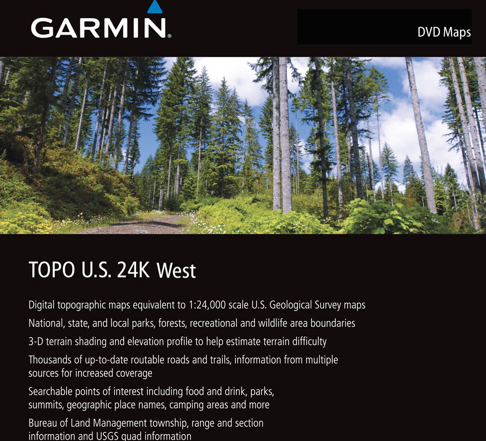
- Level of Detail is high 1:24,000
- Public and private land boundaries
- High-resolution satellite imagery available with subscription
- Turn-by-turn directions on roads and trails
- Terrain contours
- Searchable points of interest
- Available in DVD and microSD/SD Card formats
- Contains detailed hydrographic features, including coastlines, lake and river shorelines, wetlands and perennial and seasonal streams
- Displays national, state and local parks, forests, conservation areas and wilderness areas.
- Includes BaseCamp software for managing data on GPS and computer, playing back routes and tracks, geotagging photos and more
- Also includes Bureau of Land Management township, range and section information, and USGS quad locations
Here Is What WE Say About It
Everything Garmin says and MORE!
I have personally used Garmin software probably since the early 2000's with both lap top and a GPS receiver. I started using Garmin products because after moving
to Arizona, just about everyone I Jeeped with had Garmins. With a common platform, we were able to easily share tracks and trail information among our group,
a great convenience.
Topo maps are what we use on the trail and for the most part, Garmin Topo 24K can replace both "streets" and topo software in your compatible devices. Now unfortunately,
Garmin like most other manufacturers have their software and devices configured so that you cannot use a competitors software on their devices and vice versa. While
it's a good business plan for them, it's not the best for consumers as there seems to be some features on one program that aren't available on another. Like I have
said many times, GPS software and devices are not all created equal. In the case of Garmin Topo 24K, it has lots going on making it a pretty good choice and the best
choice of software from Garmin for the trail.
Topo 24K regional map sets probably started hitting the markets around 2009 and a year or so later regions covering the entire country were available. Regional sets
have an MSRP of around $129 for the DVD version so the entire country will set you back several hundred dollars for sure. A far cry from the $99 Topo 100K that Garmin
offers that covers the entire country on one DVD? Because the 1:24,000 scale gives you impressive resolution not available on the 1:100,000 version and the roads and
trails are 100% routable with turn by turn directions. Besides do you really need maps for the entire country? Most of will limit your off-road adventures to
the area you live in. So in my case, Arizona, I can get by with the Southwest (Utah, Colorado, Arizona, and New Mexico) and West (Washington, Oregon, California,
and Nevada) Regions which will cover 95% or more of my back road travel.
On your computer, Topo 24K is used with either MapSouce v 6.16.3 or Garmins newest offering, BaseCamp. MapSource is much more user friendly and has some features
I prefer over BaseCamp. BaseCamp is loaded with neat new features and while it takes a while to get used to (not very user friendly), is fun to play with and learn.
The day will come
that I will totally abandon MapSource but that day isn't here yet. Unlike MapSource, BaseCamp prints out maps with UTMs, a nice feature. But, MapSource has
a pretty good users manual, and BaseCamp has no manual. Both will create routes and waypoints so you can plan your trip ahead of time on the "big screen".
Then you can send and receive maps, routes, way points and tracks to and from your
Garmin handheld GPS. For Nuvi products you can send and receive maps, routes and waypoints. Some Nuvi's have tracks you can download to MapSource or BaseCamp
but none of them are able to accept uploaded tracks. Perhaps one day Garmin with make a nice 5" or 7" GPS for your SUV that has all the features of their hand held
units.
The look of the maps is pleasing with great color and detail. There are some short comings though, just as there are with their competitors software. Some
trails and parts of trails are missing. I've compared Garmin 24K with Garmin 100K side by side and I was shocked to see that some trails were partially or totally
missing on the 24K screen that were very clearly shown on the 100K screen. At the same time, the 24K version has shown many trails that don't show up on the 100K
version so in my opinion, the 24K version is still the one to buy. The Garmin 24K when compared to both the Delorme Topo and National Geographic Topo wins hands down
with 24Ks abilty to accurately route not only roads and streets but also TRAILS! When looking at some popular trails in Arizona, Delorme had missing information
but National Geographic compared more favorably than Delorme. Heed this bit of advice no matter what GPS or software you use out on the trail: ALWAYS carry
a paper map as a backup!
My biggest complaint with Topo 24K? Nope, its not the price, I am prepared to and will pay a premium price for gear that has features I want and need. 24K fits
that bill. I cannot use 24K in my vehicle on a laptop with a GPS receiver/antenna to see and record my trip in real time. It was something you could do with
the discontinue nRoute program from Garmin but 24K is not compatible with nRoute.
The bottom line here is overall, Garmin Topo 24K is the BEST offering among all the household names in GPS. Is it perfect? No it isn't. Is it the only
program I use, no it isn't but it I could have real time info on my laptop using this program, I just might be compelled not to use the others that I
still continue to use. On my Garmin dash top units (yes I actually have two GPS units going at a time in my Jeeps) I have both Topo 24K and Topo 100K installed.
Topo 24K is my main go to mapping solution but if in the event a trail disappears on the map or isn't showing, I switch to the 100K to see if by some chance
it might have it. Sometimes, not many it does. If not, it's back to the reading glasses and the paper map which is very, very infrequently.
Spend the extra money and buy this one first. You will thank me later :-)
Check out some screen shots below. The first two compare screens of both MapSource and BaseCamp. The rest are screenshots of urban, rural and middle of no-where.


|
 |
Want to have YOUR Product Reviewed Here?
If you have a quality product that can be used by the off-road pubic we would be glad to test it, do a fair write up about it
and make an honest recommendation about it.
Products that we feel are useful to off-road travel whether it be Jeep related or camping related will not only be posted on our website but we will submit them
to one of several magazines for more possible exposure.
Email info@jeepexpeditions.org with detailed information about your product and your interest in working with
our organization.
------------------------------------------------------------------------------------------------------------------------------------------------------
*The opinions expressed in this product review are the opinions of the writer and are based on the writers tastes and preferences. The writer
may have and in most cases invited other people to participate in this review. Despite the review (favorable/unfavorable)
you are encouraged to try out any product that you might be interested in.
**Copyrighted images & trademarks for products/items appearing on this website and/or portrayed and reviewed here
are the property of their respective owners
and are used within for informative and identification purposes only.
|
|
Jeep Expeditions is the PREMIERE Jeep Exclusive Expedition/Overland Adventure CLUB Anywhere!
Jeep Expeditions is a non-profit corporation registered in the State of Arizona.
The state recognizes us as a fraternal
organization, we prefer to say we are a club. Our members and volunteers are dedicated to the exploration of
this great land for the educational value, historical value, scenic beauty, the geology, paleontology, the camaraderie of people
who share the same interests and to escape the confines of civilization if only for a few days. Our organization and members adhere to the
standards of "Tread Lightly" and "Leave No Trace".
Jeep Expedition Members enjoy adventures that vary in length from one day, a weekend, long weekend, week long, two weeks and like our Arctic
Expedition in 2025, Forty Five Days! Don't worry, most of our trips are one day and two day trips. We are Family Friendly and we have
a number of members who bring their friendly "Jeep Dogs".
Copyright © 2006 - 2025 Jeep Expeditions, Inc. All Rights Reserved.
Jeep Expeditions Group, Jeep Expeditions, Inc., Jeep Expeditions, JeepExpeditions USA, JeepExpeditions.org. JeepExpeditions.club,
JeepExpeditions.com and other names we use along with domain names owned by Jeep Expeditions, Inc are all Copyrights & Trademarks held by
Jeep Expeditions, Inc. d/b/a "Jeep Expeditions" We also own Copyrights and Trademarks to our logo, Trip Decals and other variations of such as shown
on this website, our Facebook Page, Twitter and Instagram accounts.
Jeep Wrangler, Jeep Wrangler Unlimited, Jeep Wagoneer, Jeep Commander, Jeep Grand Cherokee, Jeep Liberty, Jeep Cherokee, Jeep Gladiator,
Jeep Scrambler, Jeep CJ, Rubicon, Renegade, Laredo, Overland, SRT-8, HEMI, Rock-Trac, Command-Trac, Selec-Trac, Quadra-Trac, Quadra-Trac II,
Quadra-Drive, Quadra-Drive II, SmartBeam, Jeep, the Jeep logo, and the Jeep grille are registered trademarks of FCA US LLC. Throughout this
web site all the preceding marks & logos are used for identification purposes only. JEEPEXPEDITIONS.ORG is an independent web site and is not
affiliated with FCA US LLC. Other trademarks and images used throughout this web site are the property of their respective owners, have no affiliation with
Jeep Expeditions and are used for informational and identification purposes only.
Terms Of Use: You may not hold the owners, operators, members (or any associated parties) of the
JEEPEXPEDITIONS.ORG or any other Jeep Expeditions, Inc /Jeep Expeditions Group web sites liable or financially responsible for any damages
including -- but not limited to -- emotional, physical, or financial damages incurred during or after the use of this web site. Use of this
web site constitutes an agreement to these Terms Of Use.
|
| |